NSC Outdoor Adventures
White Mounth
Distance: 20km/13miles, 1095m ascent
Walk Duration:
8hrs
Spaces: Maximum 10, minimum 3.
Notes: Extremely
Strenuous. Hillwalking gear required. Packed lunch and snacks required.
Maps:
Landranger 43 & 44, Explorer 387 & 388
While not a Right of Way or even drove road this
is the highest recognised hill route in the UK and more if taking in the Munro
summits along the way, which it skirts on the map. Starting from Loch Muick
it follows the path towards Meikle Pap and the Lochnager complex.
Once on the plateau it is relatively straightforward walking to Cac Carn Mor a
subsidiary top of the mountain, though a detour to the summit Cac Carn Beag
(1155m) is a good idea. We then go over the Munro Carn a' Choire
Bhoidheach (1110). From here it reaches the White Mounth
plateau's westerly peak Carn an t-Sagairt Mor (1047) before descending to Lochallater
Lodge and joins Jock's Road before finishing at Auchallater. A variation
of this is the Glen Callater to Moulzie and Glen
Doll walk which avoids the long drive round to Loch Muick!
 |
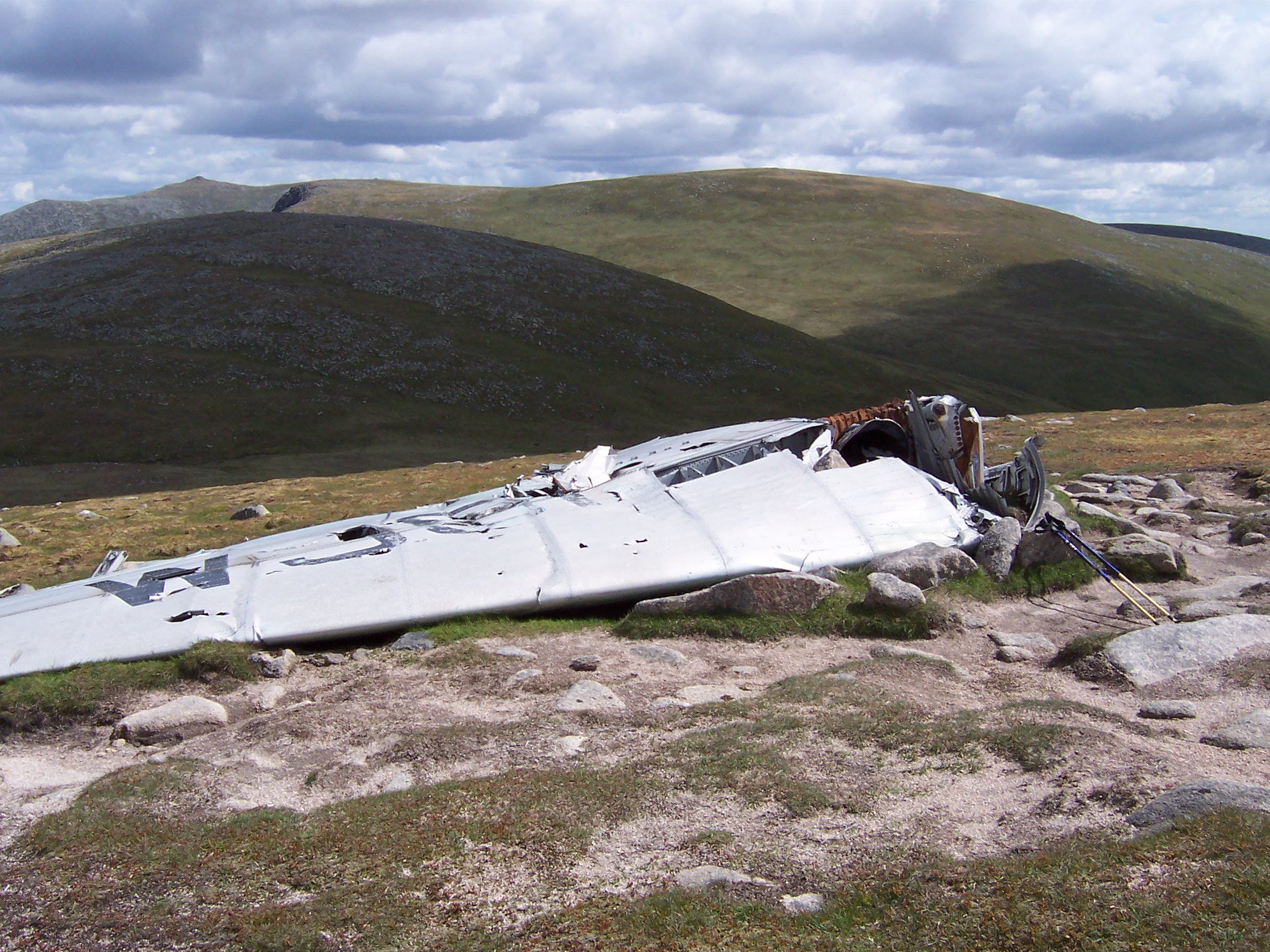 |
| Lochnagar cliffs | Remains of a Canberra on Carn an t-Sagairt Mor |